We know how to address the specific needs of engineers and architects
For many years, GDi GÉORADAR-DÉTECTION has closely partnered with architectural and engineering firms throughout Quebec to provide vital information and data that eliminate conflicts, project delays, and potential risks. Our range of specialized services is specifically designed to meet the precise needs of your field:
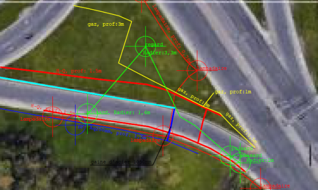
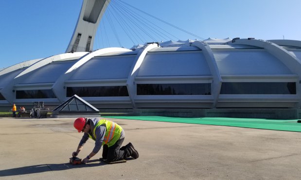
1. Pipeline Detection :
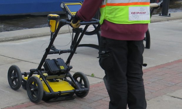
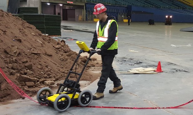
With our expertise in ground-penetrating radar (GPR) and electromagnetic locators, we are capable of detecting and locating underground utilities. This informed capability allows you to prevent potential interferences and confidently plan future projects.
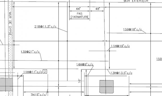
2. Structural Rebar Characteristics :
Our advanced non-destructive techniques offer in-depth understanding of the reinforcement in your structural elements. From spacing to overlaps, rebar diameters to concrete compression strength, our accurate information aids decision-making in the context of concrete structure evaluation.
3. Slab Analysis :
If you have specific requirements for analyzing your slabs, our advanced non-destructive detection techniques provide precise information while preserving the integrity of the existing structure—a crucial consideration, especially when detecting radiant heating system pipelines.
4. Corrosion Mapping of Rebar :
Through our advanced ground-penetrating radar auscultation techniques, we can meticulously map areas of potential rebar corrosion, offering a unique perspective in effective planning for core sampling and laboratory analysis.
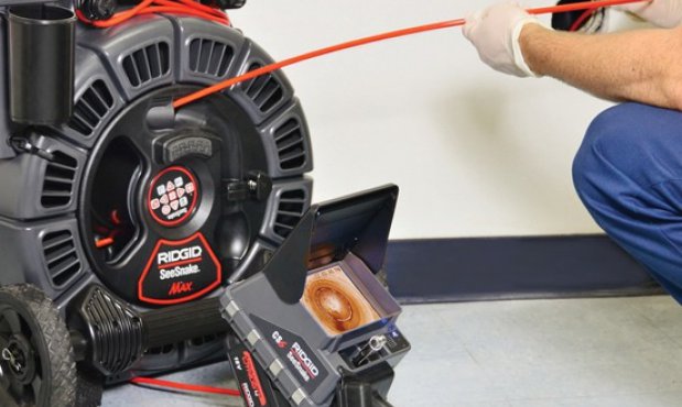
5. Pipeline and Network Inspection :
Our pipeline detection and thorough sewer and network inspections utilize advanced techniques to detect and evaluate potential issues, ensuring the health and durability of your infrastructure.
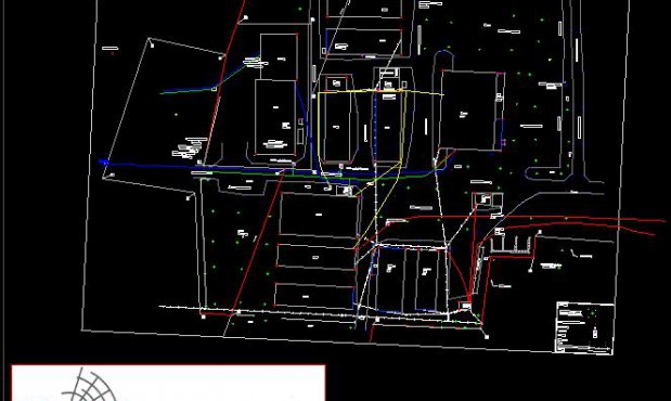
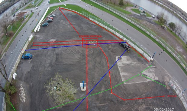
6. GPS Survey and Georeferenced Mapping :
Thanks to our surveying skills, we create detailed plans of your underground networks, buried reservoirs, and remnants of ancient foundations. This georeferenced mapping serves as the foundation for precise planning in the field of civil engineering.
We employ a range of cutting-edge techniques and technologies, including ground-penetrating radar (GPR), electromagnetic locators, electromagnetic induction instruments (EMI), thermography, and GPS surveying to achieve accurate and reliable results. With GDi GÉORADAR-DÉTECTION, you gain access to precise X and Y locations, reliable depth estimates, and detailed georeferenced plans to make informed decisions in the field of pipeline detection.
Trust our expertise and resources to provide the necessary information for the success of your structural evaluation or civil engineering projects while minimizing risks.
We know how to meet your specific needs:
- Use of many technologies
- Complete data with non-destructive technics
- GPS survey
- Drawing service
- Professional reports