
Structural Concrete Scanning Using Ground-Penetrating Radar
Locating Reinforcement, Conduits, Cables and Embedded Elements in Concrete
Before drilling, sawing, coring or modifying a concrete structure, it is essential to accurately identify the elements embedded within it.
Since 1996, GDi Géoradar Détection inc. has performed structural concrete scanning throughout Quebec for residential, commercial, institutional, industrial and municipal projects.
Our non-destructive investigation methods allow us to locate and map embedded elements in slabs, walls, beams, columns and other reinforced concrete structures.
What Can Be Detected During a Concrete Scan Using Ground-Penetrating Radar?
Depending on the conditions of the structure, our equipment can be used to locate:
- Reinforcing bars (rebar)
- Wire mesh
- Electrical conduits
- PVC conduits and other non-metallic conduits
- Post-tension cables
- Radiant heating pipes and wires
- Utility sleeves
- Voids and internal anomalies
- Areas deteriorated by corrosion or salt
- Concrete thickness
- Rebar diameter, spacing and concrete cover
When Should Structural Concrete Scanning Be Performed?
Our services are frequently used for:
- before drilling anchors and fasteners
- before sawing concrete slabs and walls
- before concrete coring
- before installing mechanical or electrical equipment
- Structural assessment
- before building rehabilitation work
- Preliminary analysis before renovation work
- Verification of existing plans
- Inspection of concrete structures
What Results Are Obtained After a Concrete Scan?
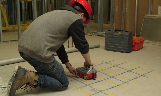
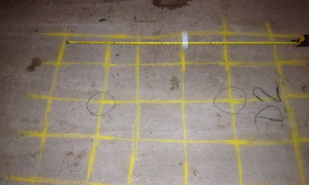
Detected elements are marked directly on the concrete in real time to facilitate the work.
Depending on the project requirements, we can also provide:
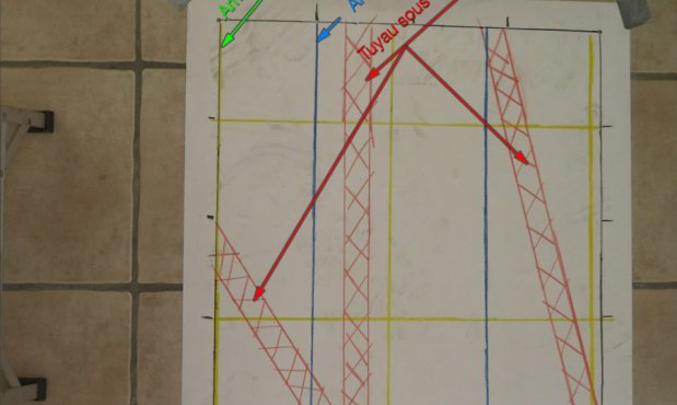
- Sketches and technical reports
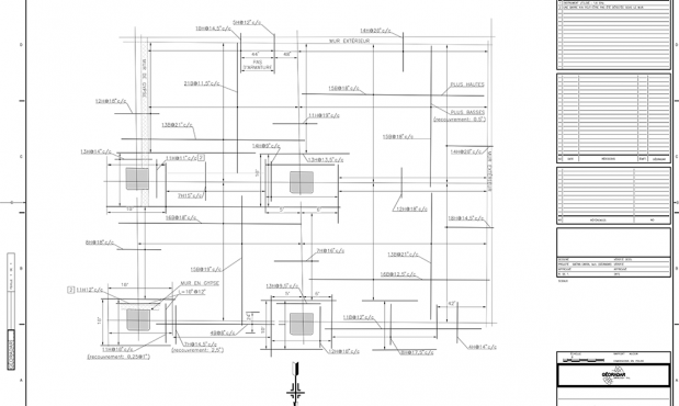
- CAD and DWG drawings
- Georeferenced data
- Photographic documentation
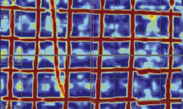
- Detailed mapping of detected elements
Why Choose GDi for Structural Concrete Scanning?
- Quebec-based company founded in 1996
- Recognized expertise in structural concrete scanning
- Rapid response throughout Quebec
- High-resolution ground-penetrating radar systems
- Use of complementary technologies
- Real-time results
- Written report included
- Experience on both simple and complex projects
What Are the Limitations of Concrete Scanning Using Ground-Penetrating Radar?
Detection capabilities depend on several factors, including:
- concrete thickness;
- the presence of moisture;
- reinforcement density;
- the presence of metallic fibers;
- the depth of the elements being investigated.
When required, several technologies can be combined to optimize the reliability of the results.
In Which Sectors Do We Perform Concrete Scanning?
- Construction
- Civil engineering
- Engineering
- Architecture
- Real estate
- Industrial
- Institutional
- Municipal
How Deep Can Elements Be Located in Concrete?
The detection depth of ground-penetrating radar in concrete varies depending on several factors, including the composition and condition of the concrete, the density of the reinforcement, as well as the size, material and depth of the elements being investigated.
For structural concrete scanning, our high-frequency ground-penetrating radar systems can generally examine concrete to a depth of approximately 24 inches (60 cm) under favorable conditions. However, the usable detection depth may be reduced when the concrete is very wet, heavily reinforced or contains multiple layers of reinforcement.
How Accurate Is Ground-Penetrating Radar for Concrete Scanning?
The accuracy of a concrete scan using ground-penetrating radar depends primarily on the depth, size and material of the elements being investigated, the density of the reinforcement, the condition of the concrete, as well as the condition of the surface being scanned.
A smooth and even surface generally allows for better positioning of the ground-penetrating radar and more accurate location results. Conversely, a very uneven, rough or milled surface may reduce positioning accuracy.
Under favorable conditions, lateral accuracy (X and Y axes) is generally in the range of ± 0.5 cm. Depth estimation accuracy is generally in the range of ± 10 to 20% of the actual depth of the detected element.
These accuracy levels may vary depending on site conditions, particularly as depth increases, when multiple layers of reinforcement are present, or when several closely spaced elements create interference.
For a quote or rapid response, contact GDi Géoradar Détection inc.
- Fast service, even for distant deployments
- Day and night service
- Professional work
- Use of many technologies
- On site marking
- Real time results
- Standard written report free of charge
- Custom report on request
Our Industries: